Oxbow National Wildlife Refuge
21 mi west · Fish and Wildlife Service
Oxbow National Wildlife Refuge, is one of the eight refuges that make up the Eastern Massachusetts National Wildlife Refuge Complex.
Outdoors
Lakes, reservoirs and rivers near Waltham for boating, kayaking, canoeing and paddleboarding.
Good to know: Life jackets are required for children on most waters, and many lakes require an invasive-species inspection or a launch fee.
21 mi west · Fish and Wildlife Service
Oxbow National Wildlife Refuge, is one of the eight refuges that make up the Eastern Massachusetts National Wildlife Refuge Complex.
25 mi southwest · National Park Service
The Blackstone River runs from Worcester, MA to Providence, RI. Its waters powered the Slater Mill in Pawtucket, RI, America's first successful cotton spinning mill.
27 mi southwest · US Army Corps of Engineers
On a quiet back road and across an old fieldstone bridge lies West Hill Park, where the West River widens to form a large, natural pool.
Map of 25 places loads as you scroll.
Oxbow National Wildlife Refuge, is one of the eight refuges that make up the Eastern Massachusetts National Wildlife Refuge Complex.
The Blackstone River runs from Worcester, MA to Providence, RI. Its waters powered the Slater Mill in Pawtucket, RI, America's first successful cotton spinning mill.
On a quiet back road and across an old fieldstone bridge lies West Hill Park, where the West River widens to form a large, natural pool.
Stellwagen Bank National Marine Sanctuary, a wild ocean place near an urban world, sits east of Boston, Massachusetts between Cape Ann and Cape Cod.
The refuge was established in 1941, and today consists of more than 4,700 acres of diverse upland and wetland habitats including sandy beach and dune, maritime shrubs and forests, cranberry bogs, man-made impoundments, salt marsh and…
The Blackstone River powered America's entry into the Age of Industry. The success of Samuel Slater's cotton spinning mill in Pawtucket, RI touched off a chain reaction that changed how people worked and where they lived.
Recognized as the Project of the Year 2000, this 200-acre lake offers state-of-the-art facilities for the latest recreational pursuits including BMX-style bike jumps, mountain bike trails and an 18-hole disk golf course.
In 1958 the U.S. Army Corps of Engineers built Buffumville Dam in Charlton, Massachusetts to provide flood risk management for downstream communities.
The Mid-State Hiking Trail traverses the park and provides easy access to this popular local hiking activity. Picnicking, canoeing, fishing and hunting are popular summer sports.
West Thompson Lake Campground is located near the wooded shoreline of its namesake lake in northeastern Connecticut. The natural setting surrounding West Thompson Lake can be enjoyed year round.
This 200-acre lake is popular with bass fishermen and anglers of all ages alike. The seasonal campground offers some sites with water and electricity, hiking trails, restrooms with showers, group picnic shelters and hunting (seasonally).
The developed, handicapp accessble park includes a 3-acre athletic field popular with softball and soccer players and kite flyers.
Westville Lake is situated on the Quinebaug River in the towns of Southbridge and Sturbridge, Massachusetts.
This 82-acre natural lake boasts the Lake Dennison Recreation Area, offering picnic areas, hunting, hiking, campgrounds and a swimming beach managed by the Commonwealth of Massachusetts.
Popular with summer and winter park visitors alike, this area offers year-round opportunities.Enjoy the swimming beaches, boating, fishing, picnicking, hiking and canoeing during the summer.
Located on the New Hampshire and Maine border, Great Bay estuary is a complex embayment and New Hampshire's largest estuarine system.
Edward MacDowell Lake is situated in a quiet corner of the Monadnock Region of New Hampshire.
A picturesque recreation area located near Peterborough, this facility is named after the famous composer and concert pianist, Edward Alexander MacDowell. In 1907 his wife, Marian, established the MacDowell Colony for artists.
Elm Brook Park is a day-use area located on Elm Brook Pool just off State Route 127 near Concord, New Hampshire.
Otter Brook Lake Recreation Area is a U.S. Army Corps of Engineers day use facility offering many outdoor recreation opportunities everyone can enjoy. The park is located in Keene and Roxbury, New Hampshire.
Surry Mountain Lake Beach is a U.S. Army Corps of Engineers day use facility located on the Ashuelot River in Surry, New Hampshire.
Townshend Lake is a flood control project operated by the U.S. Army Corps of Engineers, serving communities within the West River Valley, and those downstream.
Stoughton Pond Recreation Area is a day use area located to the north of North Springfield Lake. Stoughton Pond is located off State Route 106 on Stoughton Pond Road in Perkinsville, Vermont.
Grout Pond is a popular destination for camping, hiking, paddling, and fishing. Located in a beautiful mixed conifer and hardwood forest, the campground has 12 reservable sites and offers easy access to over 10 miles of mulituse trails.
Hapgood Pond Recreation Area and Campground is situated next to its scenic namesake pond, 13 miles east of Manchester, Vermont. Visitors enjoy camping, canoeing, kayaking, fishing, swimming, and hiking.
Distances are straight-line miles from the center of Waltham. Listings come from Recreation.gov’s federal recreation database; check each official page for hours, fees, fire restrictions and closures before you go.

THINGS TO DO · YOUTUBE SHORT
The Charles River Museum of Industry & Innovation opens its storage area, nicknamed the Wayback, to show objects not on display.
Watch on YouTube ↗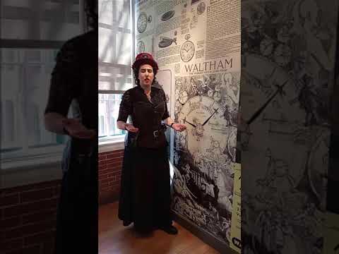
THINGS TO DO · YOUTUBE SHORT
A costumed guide from the Watch City Steampunk Festival explains how the Waltham Watch Company gave the city its nickname.
Watch on YouTube ↗Oxbow National Wildlife Refuge (Fish and Wildlife Service), about 21 miles west of Waltham as the crow flies. Next are John H. Chafee Blackstone River Valley National Heritage Corridor (25 mi) and West Hill Park (27 mi).
Based on Waltham’s average highs, May–September. Conditions at higher elevations can be much cooler.
Federal agencies including US Army Corps of Engineers, Fish and Wildlife Service, National Park Service. Each listing links to its official page for hours, fees, closures and current conditions.